Laser, Vegetation and Ice Sensor (LVIS)
WEBSITE:
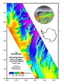
NASA's Laser Vegetation Imaging Sensor( Land, Vegetation, and Ice Sensor) or LVIS, is a scanning laser altimeter instrument that is flown, by aircraft, over target areas to collect data on surface topography and vegetation coverage. The LVIS, which also includes data from an integrated inertial navigation system (INS) and global positioning system (GPS), is designed, developed and operated by the Laser Remote Sensing Laboratory, at Goddard Space Flight Center.
Key Staff
- Principal Investigator: J Blair
- Co Investigator: David Rabine
- Co Investigator: Michelle Hofton