Missions & Projects
Alphabetical
By Last Name:
Displaying records 1 to 21 of 21.
Show:
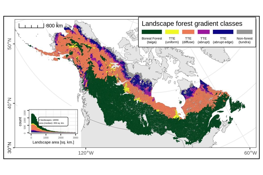
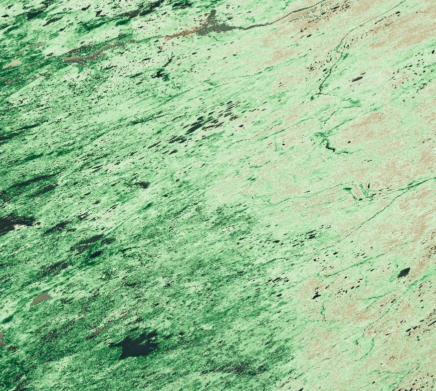
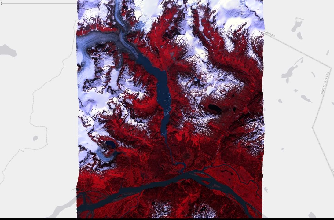
A shift in transitional forests of the North American boreal will persist through 2100
This research developed a machine learning model to predict current and future boreal forest canopy heights across northern regions using satellite data and climate projections. The study combines NASA's ICESat-2 satellite's vegetation height observations with climate and soil data to understand how forest canopy heights might change under different future climate scenarios. (Summarized with AI)
Key Staff
- Principal Investigator: Paul Montesano
- Project Manager: Mark Carroll
- Project Scientist: Melanie Frost
- Project Scientist: Jian Li
AI CoE support (AI CoE)
The Data Science Group co-leads the Goddard AI Center of Excellence by connecting partners, hosting events and training, and consulting on cutting-edge AI models for NASA.
Key Staff
- Project Lead: Mark Carroll
- Project Scientist: Melanie Frost
- Project Scientist: Jordan Caraballo-Vega
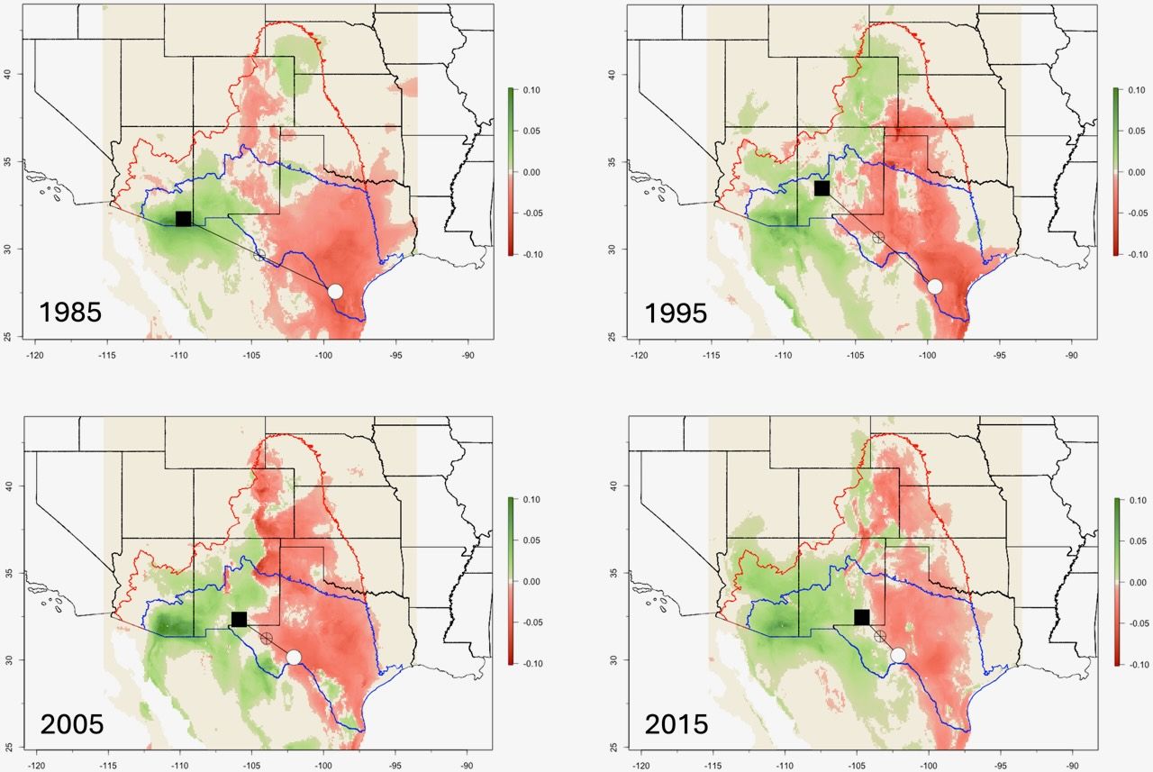
Cutting-edge models for Conservation: Ensemble machine learning advances ecological forecasting and reveals 40 years of changing climatic suitability for an aridland bird
Using ensemble machine learning and spatial analysis applied to tens of thousands of eBird records together with NASA’s MERRA-2 reanalysis, NASA researchers documented shifts in climatic suitability for Cassin’s Sparrow across the past four decades. These shifts appear to be altering the timing of the species’ breeding cycle, suggesting that seasonal climatic change may be driving both behavioral and evolutionary responses.
Key Staff
- Principal Investigator: John Schnase
- Project Manager: Mark Carroll
- Project Scientist: Paul Montesano
GenCast predictions using GEOS-FP data (GenCast-FP)
Generate GenCast Predictions with GEOS-FP data
Key Staff
- Software Developer: Alexander Kerr
- Software Developer: Glenn Tamkin
- Software Developer: Jian Li
- Software Developer: Jordan Caraballo-Vega
- Project Manager: Mark Carroll
- Project Scientist: William Putman
Global Modeling Initiative (GMI)
The Global Modeling Initiative (GMI) Chemical Transport Model (CTM) is part of the NASA Modeling Analysis and Prediction (MAP) program. The GMI CTM is used to assess the impacts of atmospheric circulation and composition change due to anthropogenic emissions, such as those from aircraft, biomass burning, fossil fuel combustion, and use of ozone depleting substances (ODS). GMI studies investigate changes in stratospheric ozone and the roles of long-range transport and changing emissions on air quality.
Goddard Institute for Space Studies (GISS) ModelE
The current incarnation of the GISS series of coupled atmosphere-ocean models is now available. Called ModelE, it provides the ability to simulate many different configurations of Earth System Models - including interactive atmospheric chemsitry, aerosols, carbon cycle and other tracers, as well as the standard atmosphere, ocean, sea ice and land surface components.
GraphCast predictions using ERA5 data (GraphCast - DSG)
Generate GraphCast predictions using ERA5 data.
Key Staff
- Software Developer: Jordan Caraballo-Vega
- Software Developer: Glenn Tamkin
- Software Developer: Jian Li
- Project Manager: Mark Carroll
High End Computer Network (HECN)
The High End Computer Network (HECN) Team supplies and maintains high performance networks for GSFC users that require advanced network capabilities, along with conducting advanced network technology research and development.

MOD44 products (MOD44)
Science-ready product development from daily MODIS surface reflectance data (MOD09).
Key Staff
- Project Lead: Roger Gill
- Project Manager: Mark Carroll
- Project Scientist: Melanie Frost
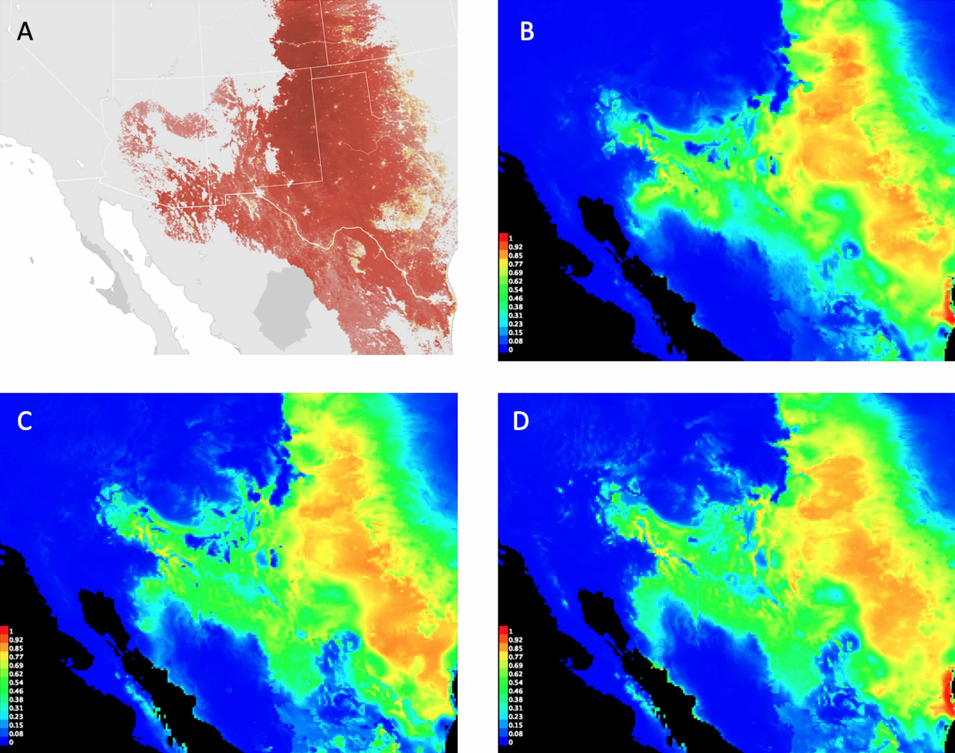
Modeling surface reflectance from VHR imagery (SR VHR)
A model of top-of-atmosphere reflectance (TOAVHR) and Landsat-derived reference (SRreference) provides a high resolution estimate of surface reflectance in VHR imagery (SRVHR). Batch production of these SRVHR estimates help identify the most similar datasets useful for large area analysis.
Key Staff
- Software Developer: Glenn Tamkin
- Software Developer: Jian Li
- Software Developer: Roger Gill
- Software Developer: Jordan Caraballo-Vega
- Principal Investigator: Paul Montesano
- Project Manager: Mark Carroll
- Project Scientist: Melanie Frost
- Project Scientist: Christopher Neigh
NASA Center for Climate Simulation (NCCS)
The NASA Center for Climate Simulation (NCCS) offers an integrated set of supercomputing, visualization, and data interaction technologies to enhance NASA capabilities in weather and climate prediction. It serves hundreds of users at Goddard, including the Goddard Institute for Space Studies, other NASA centers, laboratories, and universities across the U.S. The NCCS centerpiece is the “Discover” supercomputer, which hosts simulations spanning time scales from days (weather prediction) to seasons and years (short-term climate prediction) to decades and centuries (climate change projection).

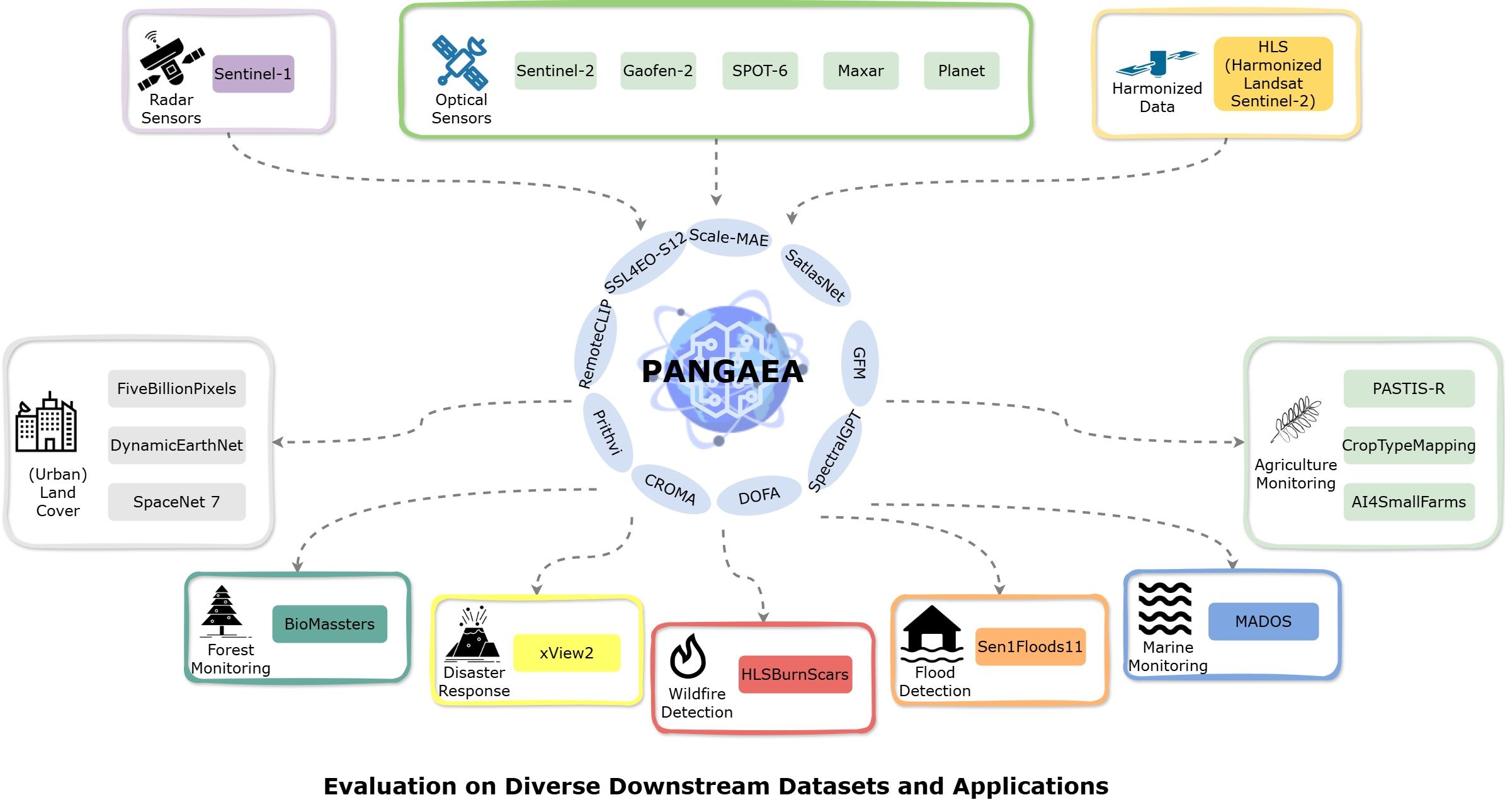
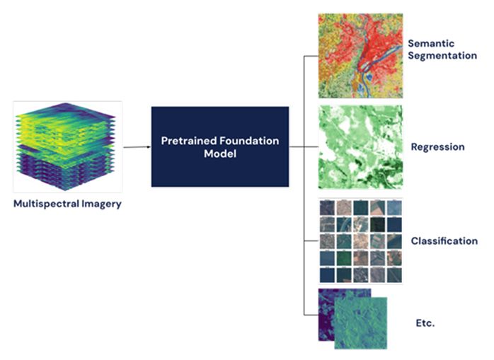
Pangaea for application of Earth Observation Foundation Models (ILab Pangaea Bench)
ILab's fork of repository with Pangaea Bench and notebooks to apply a variety of Earth Observation Foundation Models (EO FMs) to various tasks.
Key Staff
- Software Developer: Alexander Kerr
- Principal Investigator: Jordan Caraballo-Vega
- Project Manager: Mark Carroll
- Project Scientist: Melanie Frost
pFUnit
A Fortran testing framework utility developed by SIVO that is available to the general public through a NASA Open Source Agreement.
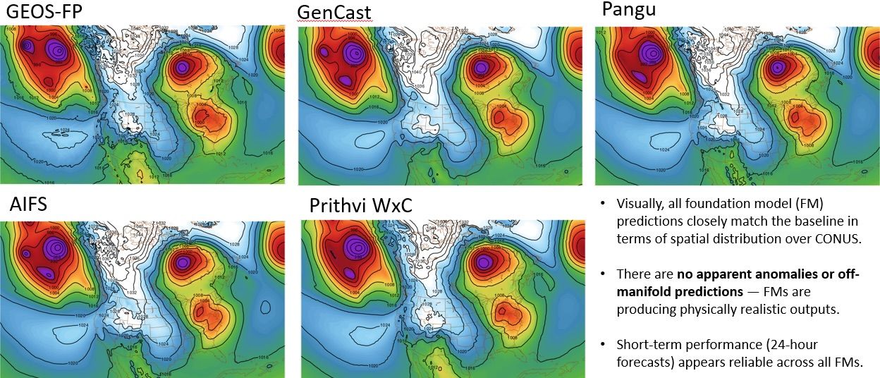
Quantitative Evaluation of Foundation Models (QEFM)
Quantify the performance of Foundation Models (FMs) for weather and climate to guide GSFC scientists in effectively integrating AI into their research.
Key Staff
- Principal Investigator: Katherine Breen
- Project Manager: William Putman
- Project Scientist: Jian Li
Retrospective Ecological Niche Modeling
Automatic variable selection assists analysis of ecological niche changes enables the use of large variable collections and the discovery of viable predictors that may not be apparent using traditional variable selection methods. It employs a Monte Carlo optimization that enables out-of-core variable selection that is "infinitely scalable" in an extensive multicore compute environment. This work is especially valuable to the species conservaion research and management communities Current customers and potential partners include NASA, NMDGF, USFWS, TAMU/NRI.
SatVision-TOA Geospatial Foundation Model (SatVision-TOA)
SatVision-TOA demonstrates the untapped potential of leveraging moderate- to coarse-resolution data for deep learning in Earth observation. By training a 3-billion-parameter vision transformer on a 100-million-image MODIS TOA dataset, it establishes a scalable, open-source foundation for advancing atmospheric science, cloud analysis, and Earth system modeling. Its released weights and workflows aim to broaden participation and foster collaboration in remote sensing applications. SatVision-TOA captures diverse atmospheric and surface conditions. Additionally, the model improves performance in 3D cloud retrieval and environmental monitoring, surpassing baseline methods.
Key Staff
- Principal Scientist: Paul Montesano
- Software Developer: Jian Li
- Principal Investigator: Jordan Caraballo-Vega
- Project Manager: Mark Carroll
- Project Scientist: Jie Gong
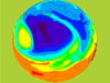
Science On a Sphere (SOS)
This mesmerizing visualization system developed by the National Oceanic and Atmospheric Administration (NOAA) uses computers and video projectors to display animated data on the outside of a suspended, 6-foot diameter, white sphere. Four strategically placed projectors work in unison to coat the sphere with data such as '3-D surface of the earth and Nighttime Lights,' 'moon and Mars' and 'X-Ray Sun.' Maurice Henderson and system administrators, Pankaj Jaiswal and Kevin Miller, have contributed their time and expertise to the deployment of Science on a Sphere at Goddard's Visitor Center.
SED Virtual Machine Environment (SEDVME)
The SED Virtual Machine Environment (SEDVME) centrally hosts and manages web server and data applications for Code 600.

SED Web Services
The SED Web Services Group provides comprehensive support for the Sciences and Exploration Directorate's web presence.

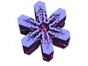
Virtual Snowflake Project
SSSO is modeling snowflake growth as part of research into retrieval of precipitation and cloud microphysical properties.